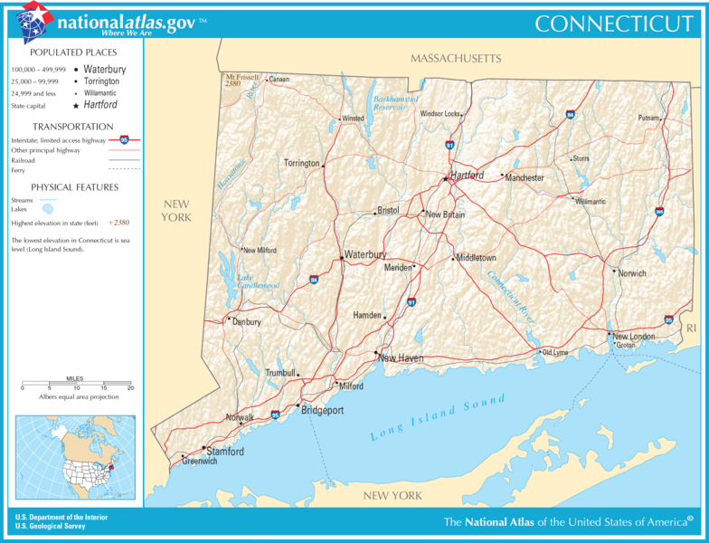
Plaetje:Map of Connecticut NA.png

Grootte van deze voorvertoning: 784 × 600 pixels. Andere resoluties: 314 × 240 pixels | 627 × 480 pixels | 1.004 × 768 pixels | 1.280 × 980 pixels | 2.015 × 1.542 pixels.
Volledige resolutie (2.015 × 1.542 pixels, bestandsgroôtte: 1,86 MB, MIME-type: image/png)
Bestandsgeschiedenisse
Klik op 'n datum/tied om 't bestand te zien zoas 't van d'r tied woas.
| Datum/tied | Miniatuur | Ofmetiengen | Gebruker | Opmerkienge | |
|---|---|---|---|---|---|
| hudige versie | 5 dec 2016 22:18 |  | 2.015 × 1.542 (1,86 MB) | Ras67 | cropped |
| 14 oes 2006 20:26 |  | 2.122 × 1.640 (1,96 MB) | Huebi~commonswiki | {{Information| |Description=Map of Connecticut |Source=[http://www.nationalatlas.gov National Atlas] }} Category:Maps of the United States Category:Maps of Connecticut {{PD-USGov-Atlas}} |
Bestandsgebruuk
Dit bestand òdt op de volgende pagina gebruukt:
Globaal bestandsgebruik
De volgende andere wiki's gebruiken dit bestand:
- Gebruikt op da.wikipedia.org
- Gebruikt op de.wikipedia.org
- Gebruikt op en.wikipedia.org
- Gebruikt op hsb.wikipedia.org
- Gebruikt op hu.wikipedia.org
- Gebruikt op mr.wikipedia.org
- Gebruikt op sw.wikipedia.org
