Plaetje:Belgium.jpg
Grootte van deze voorvertoning: 551 × 599 pixels. Andere resoluties: 221 × 240 pixels | 441 × 480 pixels | 1.002 × 1.090 pixels.
Volledige resolutie (1.002 × 1.090 pixels, bestandsgroôtte: 276 kB, MIME-type: image/jpeg)
Saemenvattieng
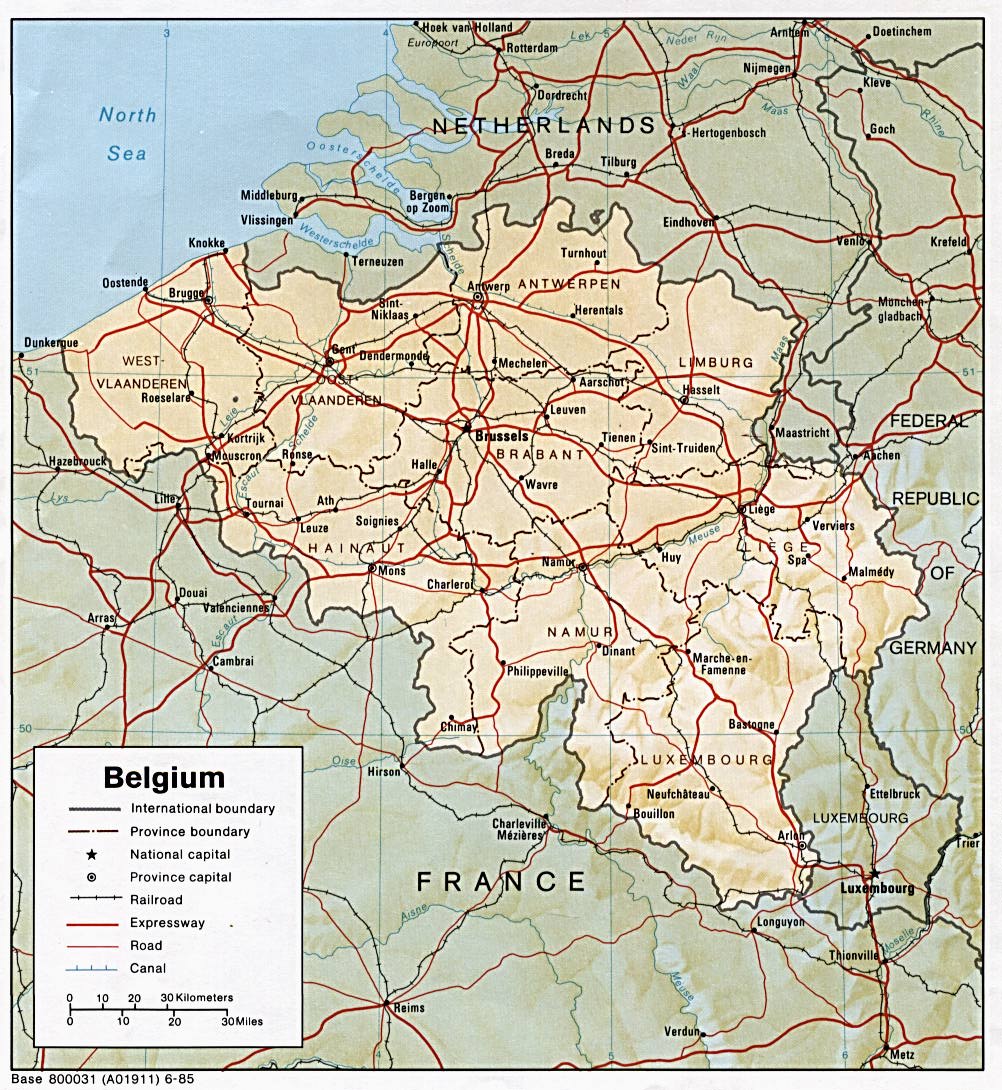
| Beschrijving | Map of Belgium, with shaded relief. |
| Datum | Downloaded and uploaded on the 20th April 2008 |
| Bron | Perry-Castañeda Library Map Collection |
| Auteur | U.S. Central Intelligence Agency |
| Andere versies | See Category:Maps of Belgium |
Licentie
| This image is a work of a Central Intelligence Agency employee, taken or made as part of that person's official duties. As a Work of the United States Government, this image or media is in the public domain in the United States.
|

|
Bestandsgeschiedenisse
Klik op 'n datum/tied om 't bestand te zien zoas 't van d'r tied woas.
| Datum/tied | Miniatuur | Ofmetiengen | Gebruker | Opmerkienge | |
|---|---|---|---|---|---|
| hudige versie | 20 apr 2008 11:25 | | 1.002 × 1.090 (276 kB) | François Melchior | {{Information |Description=Map of Belgium, with shaded relief. |Source=[http://www.lib.utexas.edu/maps/belgium.html Perry-Castañeda Library Map Collection] |Date=Downloaded and uploaded on the 20th April 2008 |Author=U.S. Central Intelligence Agency |Per |
Bestandsgebruuk
Dit bestand òdt op de volgende pagina gebruukt:
Globaal bestandsgebruik
De volgende andere wiki's gebruiken dit bestand:
- Gebruikt op de.wikipedia.org
- Gebruikt op en.wikipedia.org
- Gebruikt op sh.wikipedia.org
- Gebruikt op uk.wikipedia.org